Rainfall Estimation from Satellite Images
(Rainfall Classification)
Deep Learning with U-Net++ and LSTM | Python, TensorFlow, Keras
Overview
This project aims to predict rainfall distribution from satellite imagery using deep learning architectures.
By leveraging satellite data from Himawari-8, the project explores how image-based models can replace costly radar systems for rainfall estimation.
The proposed method combines U-Net++ for spatial feature extraction and LSTM for temporal sequence learning to improve rainfall classification accuracy.
Background
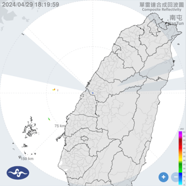
In Taiwan, meteorological radars are used to collect weather data; however, their coverage area is limited, and expanding coverage would significantly increase costs.
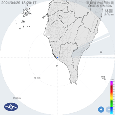
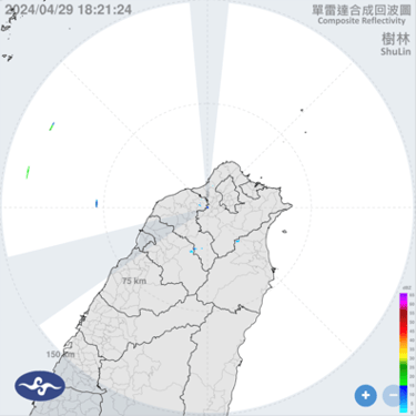
To address this, satellite imagery—particularly from Himawari-8, operated by the Japan Meteorological
Himawari-8
Himawari-8 captures multispectral images of the Asia-Pacific region every 10 minutes, using its Advanced Himawari Imager (AHI), which consists of 16 channels (3 visible, 3 near-infrared, and 10 infrared).
Researchers from the Department of Atmospheric Sciences, National Central University (NCU) utilize infrared channels (7–16) to analyze cloud physical properties and infer rainfall conditions.
Dataset
Source: Himawari-8 Satellite & Central Weather Administration (CWA), Taiwan
Coverage: Japan, East Asia, and the Western Pacific
Resolution: 500m–2km per pixel, 10-minute temporal resolution
Classes:
No Rain (0–0.5 mm)
Light Rain (0.5–5 mm)
Medium Rain (5–15 mm)
Heavy Rain (≥15 mm)
Non-Taiwan regions are marked as NaN to exclude irrelevant data.
Methodology
Data Preprocessing – Filtering satellite images, generating rainfall labels, and handling missing data.
Model Architecture
U-Net++ for spatial rainfall pattern extraction.
LSTM for capturing temporal rainfall dynamics.
Model Training & Validation – Split into training and validation sets; optimized using IoU and mIoU metrics.
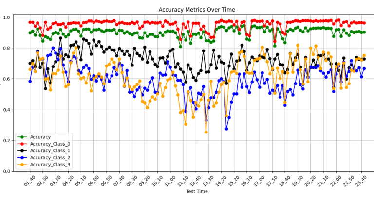
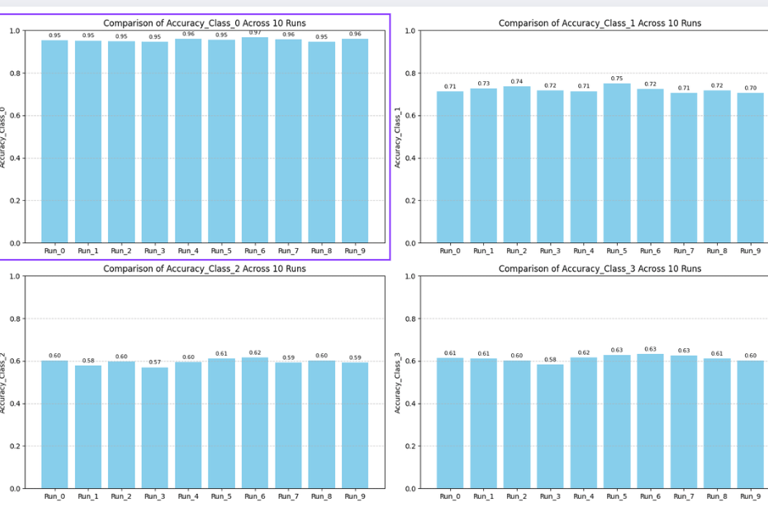
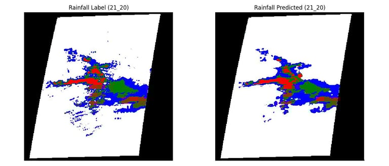
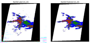
Evaluation – Assessed using Accuracy, IoU, mA, and mIoU to measure classification performance.
Key Results
The U-Net++ + LSTM hybrid model achieved higher spatial consistency and improved rainfall classification accuracy compared to baseline CNNs.
Demonstrated that satellite-based models can complement or replace radar systems, reducing operational costs for weather forecasting.
Visual rainfall predictions closely align with observed radar data across multiple regions in Taiwan.